
Facts and stats about Liberia
- Agriculture 95
- Background 7
- Conflict 2
- Cost of living 30
- Crime 14
- Culture 14
- Economy 1730
- Education 542
- Energy 368
- Environment 153
- Geography 79
- Government 152
- Health 274
- Import 2
3.99 million
Population. Ranked 127th in 2013.
$421.70
GDP per capita. Ranked 173th in 2012.
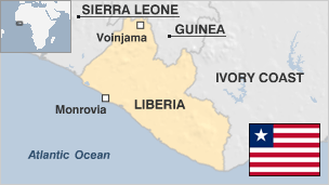
96,320 sq km
Sq. km. Ranked 102nd in 2008.