
Facts and stats about Madagascar
- Agriculture 121
- Background 10
- Conflict 1
- Cost of living 49
- Crime 23
- Culture 16
- Disasters 2
- Economy 2732
- Education 427
- Energy 433
- Environment 200
- Geography 85
- Government 210
- Health 306
- Import 4
22.6 million
Population. Ranked 52nd in 2013.
$447.44
GDP per capita. Ranked 172nd in 2012.
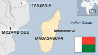
581,540 sq km
Sq. km. Ranked 42nd in 2008.