
Facts and stats about Pakistan
- Agriculture 166
- Background 10
- Conflict 1
- Cost of living 53
- Crime 83
- Culture 27
- Disasters 3
- Economy 3162
- Education 576
- Energy 949
- Environment 216
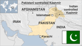
- Geography 88
- Government 224
- Health 333
- Import 6
193.24 million
Population. Ranked 6th in 2013.
$1,290.36
GDP per capita. Ranked 139th in 2012.
770,880 sq km
Sq. km. Ranked 34th in 2008.