
Facts and stats about Thailand
Author: jaacosta47
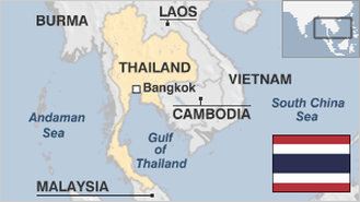
The lingering political crisis in Thailand seems to have increased pressure on an economy that used to be hardy despite turbulence in the past. In fact, national statistics revealed that imports plunged by 15.5 percent at the start of 2014 which is the most significant slip since October of 2009. Exports also went down by nearly two percent following an increase of 1.9 percent by the end of December. Economists assert that although seasonal factors may help explain the excessive drop in imports, political unrest which started last November has adversely affected Southeast Asia's second largest economy. On a positive note, the country’s stock market and foreign exchange currency has been impervious to the turmoil. The benchmark Stock Exchange of Thailand index closed at 1.6 at the start of the current week which is the highest close since December 25 of last year. On the other end, analysts are getting more apprehensive that the nation can lose valuable time in expanding transportation infrastructure and implementing changes that can help attract foreign investments. In view of the present political discord, Thailand should set in motion exports by allowing the currency to slide down. Or, the government of Prime Minister Yingluck Shinawatra can heighten expenditures that can increase the speed limit of national economy. The Baht has already gone down by roughly 10 percent although the current condition of comparative stagnation cannot justify “shock devaluation.” This can lead to deficit spending. The Thai economy has developed for the last three decades. If not for the political predicament, the growth could have been exceptional. International observers expect the positive performance to be sustained especially if the nation’s internal problems will be resolved right away.
- Agriculture 178
- Background 8
- Conflict 4
- Cost of living 55
- Crime 107
- Culture 22
- Disasters 9
- Economy 3339
- Education 655
- Energy 1138
- Environment 243
- Geography 84
- Government 205
- Health 321
- Import 7
67.45 million
Population. Ranked 20th in 2013.
$5,479.76
GDP per capita. Ranked 86th in 2012.
510,890 sq km
Sq. km. Ranked 47th in 2008.