
Facts and stats about Tanzania
- Agriculture 110
- Background 8
- Conflict 1
- Cost of living 53
- Crime 46
- Culture 21
- Disasters 4
- Economy 2043
- Education 537
- Energy 587
- Environment 204
- Geography 86
- Government 186
- Health 274
48.26 million
Population. Ranked 27th in 2013.
$591.19
GDP per capita. Ranked 162nd in 2012.
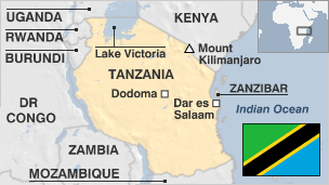
885,800 sq km
Sq. km. Ranked 30th in 2008.