
Facts and stats about Barbados
Author: jaacosta47
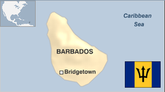
Barbados Island is separated into 30 constituencies with a representative Democratic Government. During general elections, representatives from each constituency are elected by their respective constituents. The party that wins the most seats in the House of Assembly emerge as the leading party. The winning party representative who secures his seat is named as Prime Minister. The Prime Minister appoints ministers to comprise his government.
Barbados is currently governed by the Democratic Labour Party (DLP) which turned out victorious in the February 2013 polls. The DLP grabbed 16 of the 30 seats while the other 14 slots were won by the political opposition (Barbados Labour Party).Prime Minister Freundel Stuart of the DLP is serving his second consecutive term. As a small country, the main direction of the government’s diplomatic policy is to become active in international organizations. Barbados is a member of the Commonwealth. It was also admitted to the United Nations in December of 1966 and the Organization of American States (OAS) in 1967.
In 1973, Barbados along with Trinidad, Tobago, Guyana, and Jamaica signed a pact in Trinidad to establish the Caribbean Community and Common Market (CARICOM). The following year, majority of the remaining English-speaking Caribbean states also joined this organization which has a current membership of 15. In July of 1994, it joined the newly formed Association of Caribbean States.
Right now, Barbados has become another victim of the economic downturn confronting the Caribbean. The truth is that the problem of Barbados can be traced to the inherent structural problems facing nations which import and consume much more than they produce and export. Barbados also does not have a competitive productive base.
- Agriculture 90
- Background 7
- Cost of living 51
- Crime 66
- Culture 12
- Disasters 4
- Economy 2370
- Education 383
- Energy 498
- Environment 111
- Geography 79
- Government 150
- Health 261
- Import 1
288,725
Population. Ranked 180th in 2013.
$13,076.46
GDP per capita. Ranked 59th in 2011.
430 sq km
Sq. km. Ranked 182nd in 2008.