
Facts and stats about Sri Lanka
Author: jaacosta47
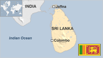
Nearly five years ago, the armed forces of Sri Lanka finally vanquished the Liberation Tigers of Tamil, a revolutionary separatist group that struggled to secure independence for the ethnic Tamil minority. It was a bloody civil war that lasted for 25 years and claimed thousands of lives as well as destroyed the economy and environment of this small island. And yet until now, the United Nations has failed to tackle serious human rights violations committed by the warring factions. Last year, the world body’s secretary general has ordered United Nations officials not to remain silent in the face of massive rights violations in Sri Lanka, as they have been in 2009. The report of the United Nations that came out in 2011 stated that both sides committed atrocities against innocent civilians. The Sri Lankan government refuted this as prejudiced. The United Nations Human Rights Council will have to vote Geneva on whether to organize an independent international probe into probable war crimes which consist of summary executions, rape and torture. Ironically, the Tamil opposition party won a convincing victory during the elections in September of last year in a decentralized provincial council in the north which was established after constitutional talks with the government. Located at the southern end of India, this sultry island has been a favourite of tourists for hundreds of years because of its natural splendour. However, Sri Lanka has been affected by the Sinhalese and Tamil clash. The bright side is that the economy of Sri Lanka has experienced robust growth rates in recent years. Based on 2012 estimates by the International Monetary Fund, the nation’s economy was valued at $64 billion and is currently ahead of other South Asian countries in terms of per capita Gross Domestic product. The major industries are tea export, tourism, textile, rice production and other farm products. Sri Lanka maintains trade and diplomatic relations with countries like the United States, Russia, India, Bangladesh, China, Pakistan, the EU, Japan, Malaysia, and, South Korea.
- Agriculture 134
- Background 12
- Conflict 1
- Cost of living 53
- Crime 70
- Culture 21
- Disasters 9
- Economy 3063
- Education 488
- Energy 728
- Environment 229
- Geography 84
- Government 217
- Health 310
21.68 million
Population. Ranked 57th in 2013.
$2,923.13
GDP per capita. Ranked 119th in 2012.
64,630 sq km
Sq. km. Ranked 116th in 2008.