
Facts and stats about Guatemala
- Agriculture 139
- Background 8
- Cost of living 53
- Crime 71
- Culture 23
- Disasters 2
- Economy 3138
- Education 554
- Energy 713
- Environment 205
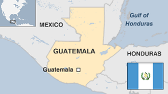
- Geography 82
- Government 192
- Health 331
- Import 3
14.37 million
Population. Ranked 69th in 2013.
$3,351.14
GDP per capita. Ranked 110th in 2012.
107,160 sq km
Sq. km. Ranked 99th in 2008.