
Facts and stats about Guyana
- Agriculture 109
- Background 8
- Conflict 1
- Cost of living 46
- Crime 33
- Culture 21
- Economy 2607
- Education 414
- Energy 373
- Environment 155
- Geography 83
- Government 185
- Health 289
- Import 2
739,903
Population. Ranked 164th in 2013.
$3,583.96
GDP per capita. Ranked 105th in 2012.
196,850 sq km
Sq. km. Ranked 82nd in 2008.
The country of Guyana is presently governed by the People's Progressive Party/Civic (PPP). Opposition parties are engaged in a unique struggle for governance in which the two combined political parties command majority in the legislature and can thus obstruct any legislation proposed by the Government. Donald Ramotar of the PPP was elected president of Guyana by a plurality of votes cast in general elections in 2011. The party failed to win an overall majority in the legislature. The country has been experimenting with an outstanding model of democracy because the polls produced no overall winner.
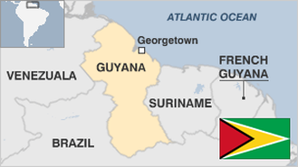
The Cooperative Republic of Guyana is a sovereign state located at the northern coast of South America. It does not belong to Anglophone Caribbean but it is a member of the Caribbean Community (CARICOM). Guyana was an original colony of the Netherlands but was colonized by Great Britain and remained a British Colony for more than two centuries until it became independent in 1966. Guyana joined the Union of South American Nations as one of the founding members. Moreover, it is a member-state of the Commonwealth of Nations and the sole South American country which has English as its official language.
The economy of Guyana demonstrated modest economic growth within the past years. It is based principally on agriculture and extractive industries. It depends on the export of six major commodities. These are sugar, gold, bauxite, shrimp, timber, and rice. They represent practically 60 percent of the country's GDP and are highly vulnerable to inclement weather conditions and rise and fall in commodity prices. Guyana maintains diplomatic relations with many nations and has played an important role in global affairs particularly among Third World countries and non-aligned nations. It has become a member of the United Nations Security Council from 1975 until 1976 and 182 to 1983.
jaacosta47 13 May 2014