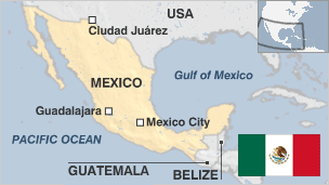
Part 3 of a Series on the Mexican racial hierarchy and its implications for America
By Steve Sailor
After almost twenty generations of intermarriage between whites and Indians, Mexico has ended up with an almost wholly white elite, a vast mixed race (mestizo) working class, and at least 10 million extremely impoverished pure Indians who have never assimilated into Hispanic culture. And the ruling class is becoming ever whiter. How did this happen? And what does it portend for America\'s dream of colorblind equality?
The first column in this series described the corruption of Mexico\'s white rulers. The second outlined race in Mexico. This will explain the mechanism through which Latin America\'s seemingly anti-racist freedom to marry across color lines produces such racially hierarchical societies - and what this implies for the U.S.
In Mexico, white conquistadors interbred with Indian women to produce mestizos. Let\'s assume that in 1519 the Spaniards and the Mexican Indians were equal in IQ and other significantly heritable traits that aid economic success. I\'ll follow Jared Diamond (Guns, Germs & Steel: The Fates of Human Societies) in stipulating that the conquistadors won solely because by luck they had the guns, germs, and steel on their side, and that the only reason they had superior technology was because Spain was less isolated than Mexico.
Now, imagine a conquistador and his Indian woman have two sons in the 1520s. These two mestizo brothers grow up and go out in the world to seek their fortunes. One is smarter, and he strikes it rich. The other wasn\'t so lucky in the genetic lottery, and he becomes poor. The rich son has a wide variety of potential wives to choose from. Like most men, and like almost all Mexican men, he is more attracted to blonde women, and thus marries one. (If you aren\'t familiar with the depths of Mexico\'s blonde obsession, try watching Spanish-language TV shows. Almost all the women on Mexican TV look like Finns.) His impoverished brother, in contrast, cannot attract a blonde wife. So he marries an Indian girl.
Then, the brothers have children. On average, the smarter, richer brother\'s kids, who are 3/4 white, are smarter than their underprivileged 1/4 white cousins. They\'re smarter not because they are whiter, but because their father had more smartness genes than their uncle. This trend continues: in both families, the smartest, most energetic, and most ruthless sons marry the blondest wives, while the blondest daughters marry the husbands with the most Right Stuff. Repeat for another dozen and a half generations. By 2000, this pattern could lead to the most European-looking people being the most naturally formidable, even if they weren\'t when they arrived in 1519.
Now, in Mexico every century or so, there is a massive upheaval like the Revolution of 1910. The white monopoly is fractured. Up through the cracks come the most talented mestizos and Indians. They start dynasties that persist to this day … but their grandsons and great-grandsons are notably whiter than they were, since the men of the family have been exploiting their social ascendancy to marry white women. (Of course, many rich Mexican men father second families with their lower-ranking mistresses. But these kids seldom get the breaks in life that the legitimate children do.)
The ruling class today is not restricted solely to the legitimate heirs of the current magnates, however. It continues to recruit smart young men from the lower orders. For example, President Ernesto Zedillo, who has a doctorate from Yale in economics, is from a quite poor background. Yet, he looks pure white (and acts that way, too -- his aides used to call him \"El Nerd\" behind his back). His mother was a medical student who dropped out for obscure reasons. There is some uncertainty about whether he really is the biological son of the obscure Mexicali electrician who raised him, or of a Finance Ministry official.
President Zedillo is the classic manifestation of Mexico\'s \"technocrat\" trend. Extremely well-educated young men with state-of-the-art managerial skills shove aside the old guard \"dinosaurs.\" The great majority of these bright young things are all or almost all white. In the U.S., we see an IQ gap of roughly half of a standard deviation between non-Hispanic whites and Mexican-American mestizos, and something like that probably holds true in Mexico too, after all this assortative mating.
Why does the Mexican government need so many technocrats? After all, Chicago\'s similar one-party machine clanks along just fine under the guidance of endearingly mediocre minds. Mexico\'s Left, however, demanded the intrusion of the state into the business world, such as the nationalization of the oil business in 1938 by the sainted President Cardenas (father of the leftist candidate for President in 2000). Ironically, nationalizing industries started the need for technocrats in government, which turned out to mean more whites at the top.
Mexico has in some ways become an IQ meritocracy rather like Imperial China. Enormous prestige and power have gone to graduates of American Ivy League universities. (Or at least to people who claim to have graduated from these universities -- quite a number of cabinet officials were recently found to have failed to complete the degrees on their official resumes.) Still, the educational levels of top government officials is radically higher than in the past, and may even be higher than in the U.S.
The technocratic ascendancy, though, has not decreased corruption or brought more justice to Mexico. Nepotism and cronyism remain rampant. The leaders became less in touch with their subjects, and less sympathetic to their needs, than at any time since the Revolution. Having a lot of Ivy League PhD’s run a semi-literate country where maybe only 2% or 3% of the population subscribe to newspapers is not necessarily a recipe for good government. In a political culture where the current President personally picked the next President, this IQ stratification meant that Presidents increasingly picked their own elitist technocrat aides, many of whom had never won an election before, rather than traditional slap-on-the-back politicians who were more in tune with the masses.
The technocrats have some successes to their names, such as Mexico\'s highly rational process of developing new tourist destinations. But after several decades of hideous corruption and mismanagement, the average Mexican is sick of technocrats. So the PRI made sure to nominate a presidential candidate this year who only had a bachelor\'s degree.
Whites have also dominated even Leftist Guerilla movements. For example, Subcommandante Marcos, who led the Chiapas Guerilla uprising in 1994, is a white college professor from Mexico City. The reason he calls himself a Subcommandante instead of a Commandant is because he supposedly answers to the real Commandants, who are all Mayan Indians. In fact, Marcos was not originally the spokesman for the rebels -- a Mayan named Commandant Felipe made the initial statements to the press on January 1, 1994. But he proved insufficiently charismatic and articulate in Spanish, so Marcos elbowed him aside a few hours later. But of course, Marcos is today the real Supercommandane and the Indians do what he says.
What does all this portend for America as we become more genetically and culturally Mexican?
Interracial marriage between whites and East Asians in California has indeed worked largely as advertised, bringing these two races quite close together. Since Asians tend to have slightly higher IQ\'s and significantly better work ethics than whites, white-Asian weddings have contributed to racial equality. The trend toward white-Asian couples, however, has benefited Asian women and hurt Asian men, since only 28% of white-Asian couples feature an Asian husband. (See my ever-controversial article \"Is Love Colorblind?\" [http://www.isteve.com/IsLoveColorblind.htm])
On the other hand, a new class system based on color is also growing more visible in Southern California. Although the men of LA are less prejudiced about women\'s hair and skin color than the men of Mexico, in LA, like most places, the blonde remains queen. As Hugh Hefner has pointed out, for 85 years Hollywood has pulled in the most beautiful blondes from all over the world, which is why native-born California women are so attractive. For generations to come, the blondes will keep arriving from all over America, Canada, and Europe, and they\'ll continue to marry the hardest charging, most successful men. This will keep LA\'s hereditary overclass blonder than is expected by today\'s Tiger Woods-bedazzled conventional wisdom.
Likewise, the Hispanic influx into California seems to be simply recreating the racial hierarchy of Latin America - rather like the freed slaves who went to Liberia set up an imitation Southern slave-owning society there. America\'s leading Latino politicians tend to marry Anglo (for example, the last two Latino Cabinet officers, the head of the Hispanic Congressional Caucus, and the last two presidents of the Mexican-American Legal Defense and Education Fund [MALDEF]). Thus, the Mexican-American elite is likely to become even whiter over the generations.
While upwardly mobile Mexican-Americans marry blonde Anglos, downwardly mobile white men wed Mexicans. Now, there is no doubt plenty to be said for getting hitched to a Mexican lady. They probably tend to make better mothers, homemakers, and cooks than the leggy blonde careerists who, however, are so much more in demand in Southern California. But sadly, there is a big social cost to Anglo-Hispanic marriages - which raises severe doubts about America\'s ability to assimilate Latino immigrants. As pro-immigration/pro-assimilation researcher Gregory Rodriguez admits, \"Surprisingly, in most homes headed by an Anglo/Latino couple, Spanish becomes the household language.\" [http://www.med.ucla.edu/cesla/oped/5-5-96.htm]
Thus, those L.A. blue-collar whites who don\'t flee to Utah will tend to assimilate genetically and culturally into Latino culture.
If the U.S. were to adopt a merit-based immigration policy like Canada\'s that favored high-IQ Asians, then skin and hair color would become less accurate predictors of intelligence and social class. However, our current nepotism-driven immigration system, which allows in so many mestizo immigrants under the family reunification provisions, is simply importing Latin America\'s race-based inequality.